Ich liebe Schwarmwissen! Nach meinen gestrigen Beitrag „EuroDEM ist Open Data“ [1] kamen über die FB-Gruppe QGIS Community – Official Virtual Group gleich zwei neue Tipps, die ich gern an Euch weiter gebe:
- EU-DME 1.1 [2]
- Continental Europe Digital Terrain Model at 30 m resolution based on GEDI, ICESat-2, AW3D, GLO-30, EUDEM, MERIT DEM [3]
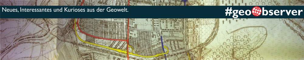
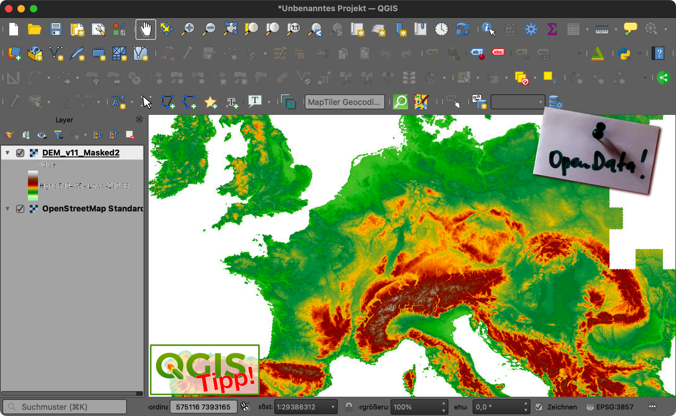
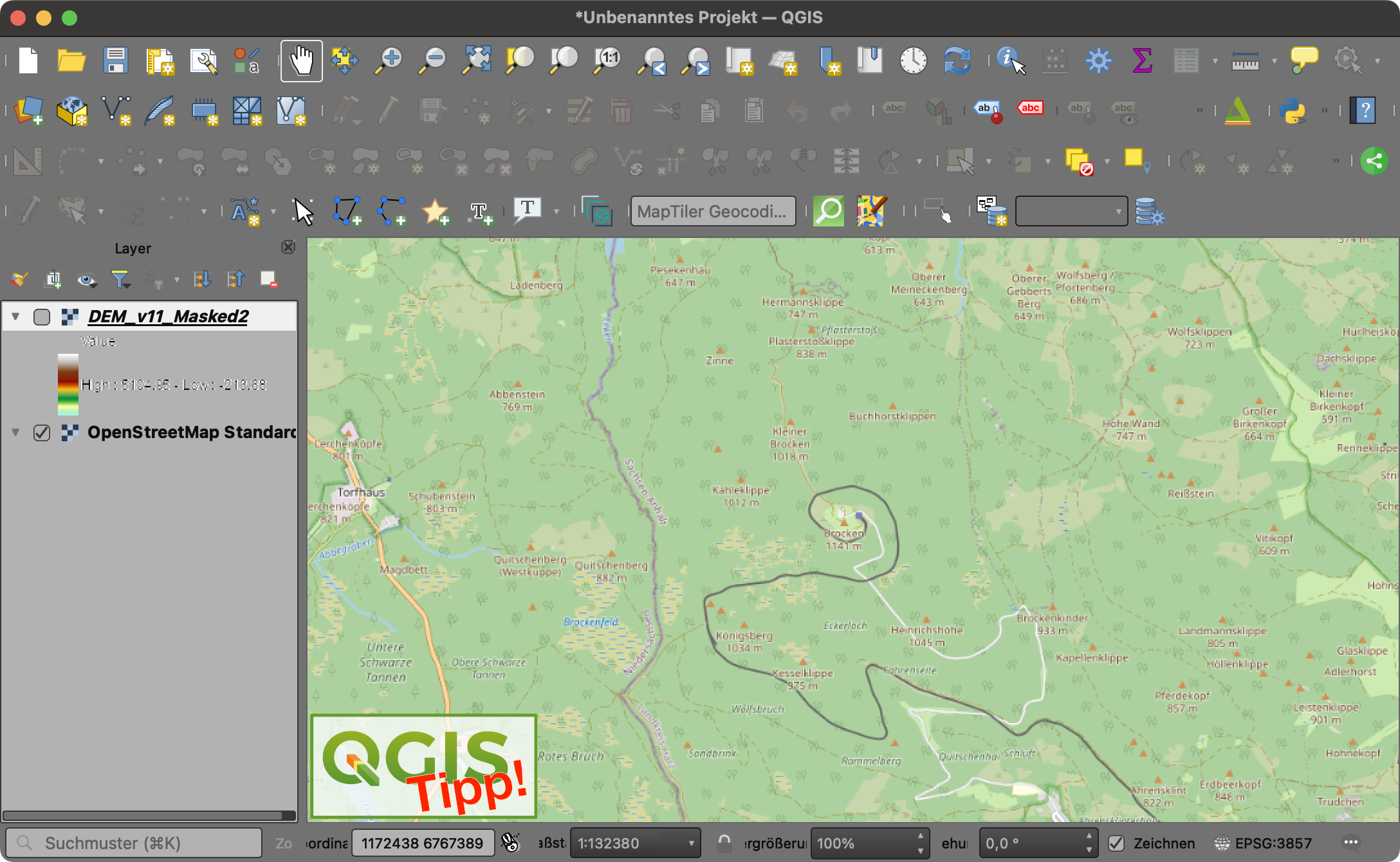
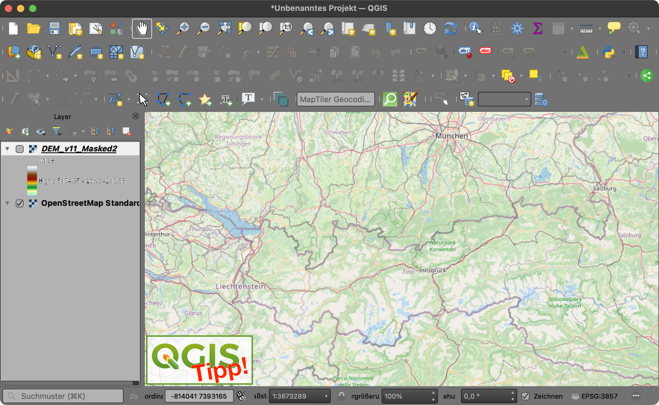
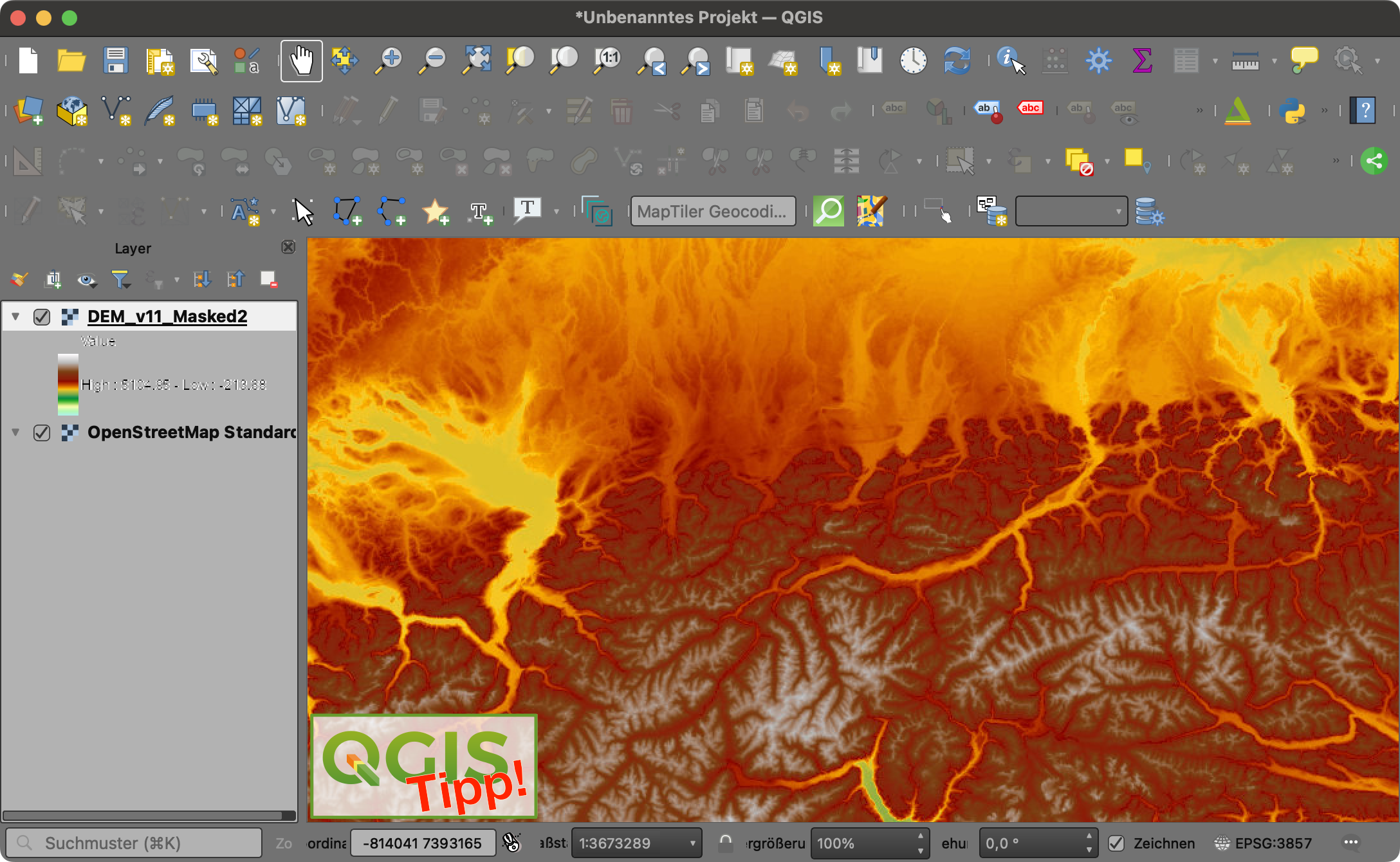
Die Daten des EU-DEM [2] habe ich als WMS [4] im QGIS eingebunden, perfekte Ergebnisse, siehe folgende Bildvergleiche. zoomt mal rein!
[1] …https://geoobserver.de/2022/05/12/eurodem-ist-open-data/
[2] … https://land.copernicus.eu/imagery-in-situ/eu-dem/eu-dem-v1.1/view
[3] … https://zenodo.org/record/4724549#.Yn3uOpNBy3J
[4] … https://image.discomap.eea.europa.eu/arcgis/services/Elevation/EUElev_DEM_V11/ MapServer/WMSServer