Immer wieder schön: das OpenData-Portal in San Franzisco. Sollte auch endlich mal in Deutschland Schule machen. Einige große deutsche Städte machen schon ganz gut mit, bei vielen hapert’s leider noch – aus unterschiedlichen Gründen ;-). Der politische Wille des Bundes jedoch ist manifestiert, z. B. beim Bundesministerium des Innern. Nun sollten die Willensbekundungen auch umgesetzt werden.
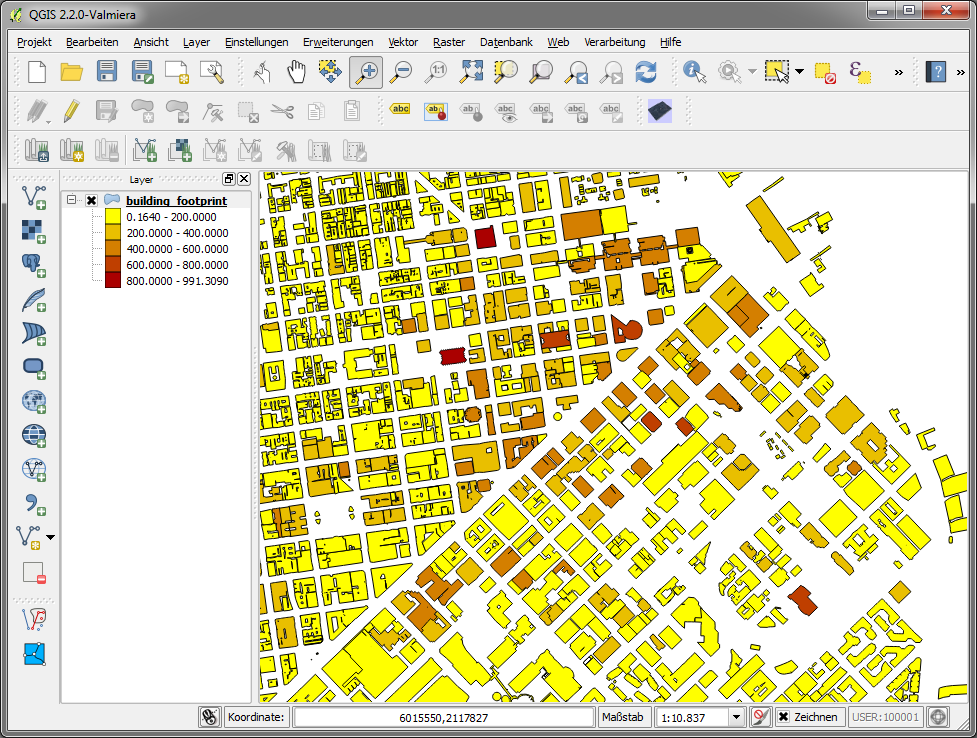
Hier die Gebäude aus San Franzisco: Download als Shape-File, beispielhaft präsentiert auf Twitter:
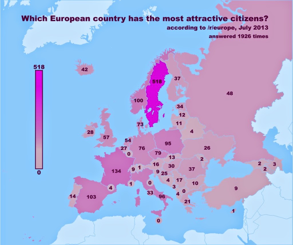
 Bildquelle: https://twitter.com/undertheraedar/status/522119471998447617/photo/1
Und mal schnell vom geoObserver im QGIS probiert – so muss OpenData!


 Quelle:

 Quelle: